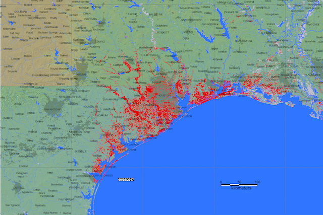
The List team’s ground-breaking method of detecting surface water from satellite radar images enables them to monitor and predict floods by quickly creating maps.
To deal with the flooding at the end of the summer, US authorities called on the Global Flood Partnership, a collaboration between scientific organisations and managers of massive global floods. They applied the algorithm developed by List’s researchers and produced flood maps of the areas worst affected by flooding, enabling them to deploy protective measures to reduce risk.
The maps were published on the Dartmouth Flood Observatory website set up by the University of Colorado in the United States, and are being made available to the Federal Emergency Management Agency. They can be viewed by visiting the Global Flood Partnership website.
The algorithm, which is still being developed, was previously implemented in the European Space Agency’s Grid processing on-demand platform, allowing access to ESA images for processing and testing.