The digital twin was announced as a priority project two years ago by Thomas Kallstenius, CEO of the Luxembourg Institute of Science and Technology (List). The twin is a virtual copy of Luxembourg, where data about the country is aggregated and that can be used for simulation, providing information, for example, to policymakers to prepare the country to face its challenges in infrastructure, traffic and other areas.
Work on the project could soon accelerate as Nomoko, the Swiss start-up charged with providing images with a precision of two centimetres via its drones, has obtained the first SORA licence from the Luxembourg Civil Aviation Authority.
SORA stands for Specific Operations Risk Assessment, an obligation that arose from new European legislation on drones at the beginning of the year. "The approval posed many challenges. It is a completely new framework for the DAC, the national aviation authority of Luxembourg, which means that we had to overcome unexpected obstacles--for example, some certification standards for things like parachutes were not yet defined, which makes them difficult to comply with," said UAV operations manager Juan Viñuales at the List Tech Day last week.
The ten-step process "when and how Nomoko can perform drone operations without endangering people and objects in the air and on the ground, explaining the risks involved and the measures taken to mitigate them," the company said in a statement.
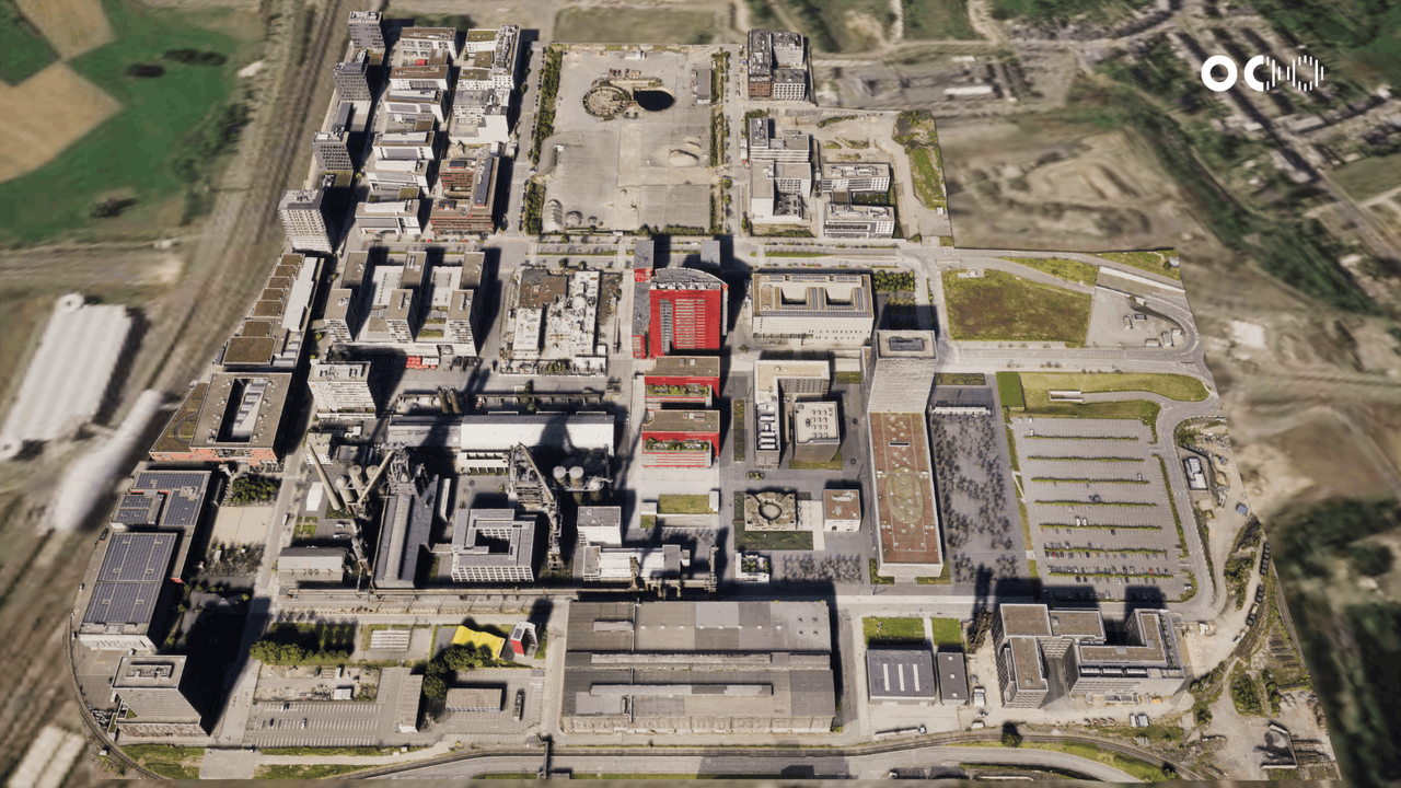
A two-centimetre view of Belval
The idea is to "convert 2D drone images into georeferenced real-scale 3D models at a much faster rate and in a more scalable way than existing methods at this level of accuracy. Entire cities in extreme detail in weeks, not months," the company said.
For the start-up, which is collaborating with List, the result is that it can make progress on its Praedia solution. "The potential of digital twins for real estate in particular is very significant--not only to digitalise and disrupt the workings of the largest financial asset class in the world but also to make it much more sustainable," said Nomoko co-founder and CEO Nilson Kufus.
At the 2021 List Tech Day on 21 September, Kallstenius showed a video of the Belval campus model, which is accurate to two centimetres. It could be used for spatial planning, resource management or traffic management. The possibilities are infinite and depend on political or scientific ambitions. For the start-up, this licence will enable it to offer its modelling services to digital twins throughout the European Union.
This story was first published on . It has been translated and edited for Delano.